This article may include affiliate links. If you click a link and make a purchase, Utah Outdoor Activities may receive a small commission at no extra cost to you. We only recommend products or services we personally use. FTC Affiliate Disclosure.
I have always wanted to climb this mountain. I have driven past it for years, as it sits directly north of Mt. Olympus. It almost has a knob-like appearance, with a spine of granite splitting outwards on the western slope. Grandeur Peak sits at the head of the Parleys canyon and the Mill Creek canyon ridge line.
The trail head is located 3.2 miles up the canyon from Wasatch Blvd. It is located in the Church Fork Picnic grounds on the left side of the canyon. As you enter the picnic grounds, please be careful on the road as it is very narrow and barely fits two vehicles. Follow this road all the way till the end. When you reach the parking lot, you will notice a small little water fall next to trail head. This is a nice place to get acclimated to the surroundings and elevation. The trail starts off on a sloping incline and continues on above the little falls that you encounter down at the trail head, then swings to the right and heads uphill. As soon as you get to the top of this little hill, you will see a mileage sign, which you can take the trail to the right, which is part of the Pipeline Trail, or you can continue on upwards to the peak. I am here to summit a mountain so on to the peak it is.
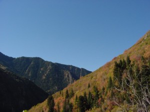
This climb to the saddle is not for the weary, and if you get tired you might want to rest often. I even found myself winded as I climbed through the aspens and pines to the head of the trail. This trail comes to a head where it switches back through gamble oak. When the sun is out, it is extremely hot and sunscreen is highly recommended. As you climb out of these switchbacks, you will see a gigantic rock formation above you which is confusing at first because it is hard to tell from this angle where the trail goes, stay on the path. It will take you to the left along the hillside to a saddle at the base of the peak.
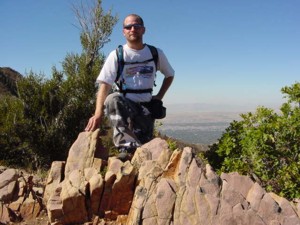
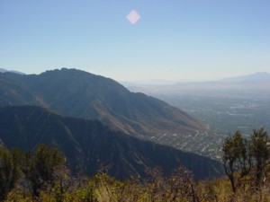
Once you reach this saddle, you will get an extraordinary view of the Salt Lake Valley, with Downtown to the north. I stopped here for about a half an hour to eat some lunch, and get ready for the climb to the peak. This is a steep climb, which switches back and climbs some stair like trails till you reach some pines on the ridge, then it seems to curve to the west and around the front of the mountain. Up another little incline and there you are. Grandeur Peak sits at 8299 feet and has a grand view indeed. Mt. Olympus and the whole Olympus cove to the south, Mt. Aire to the east, and Mt Raymond to the southeast. To the North you have grand view of the city and the Great Salt Lake. I spent quite some time here, taking in the view. The hike down was a great trail run and a lot faster than the way up. I shall return here for sure and recommend this hike to anyone looking to summit a mountain.
Trail Information:
Mill Creek Canyon - Trail head - Church Fork Picnic Grounds.
3.2 miles up canyon.
Distance to Grandeur Peak- 2 ¾ miles
Elevation Gain- 2619 feet to 8299 feet at summit.
Hiking Time- 3 hours.
We hope you enjoyed this information. For more outdoor activities, please connect with us on YouTube, Facebook and Instagram. Help us keep this site up and running by visiting our online store which features outdoor themed gifts, decor and more. Thank you for visiting and for your ongoing support!