This article may include affiliate links. If you click a link and make a purchase, Utah Outdoor Activities may receive a small commission at no extra cost to you. We only recommend products or services we personally use. FTC Affiliate Disclosure.
Mt. Aire is located up Mill Creek Canyon. As we started off it was a sweltering summer day in the valley, and so our intentions were to get up out of the heat, and into cool Mill Creek Canyon. The Forest Service charges a fee to access the canyon which you pay as you exit. I think this fee is well worth it as they keep these trails scrawl free unlike the rest of the trails in the Wasatch which can be quite rugged.
Most of the trails allow dogs and mountain bikes, which add to the wear and tear on these trails. But thanks to the forest service they are well groomed so there is not allot to slip on heading up and down. This trail starts at the Elbow Fork Trail Head up Mill Creek. It begins as a small incline that after a bit forks to the left, if you go to the right it will take you to Lamb’s Canyon.
But since we were headed to Mt. Aire, it was off to the left we go, and up another incline, then left again to climb another steep hill.
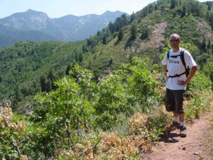
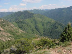 You will arrive at a set of switchbacks that will lead you through some skunk cabbage and up another steep hill to the Mt. Aire pass. We started the hike up a small foot track that headed left from the pass. Soon it started to switchback up until we were well above the pass. The view was great; we could even see Gobblers Knob, which we conquered earlier this year. There was hardy a cloud in the sky so the views were awesome. We continued up to the summit, which is pretty barren so we were feeling the affects from the heat.
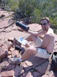
Mt. Aire sits at 8621 feet in elevation, as soon as we were on the top, we noticed a black PVC tube with a lid, it was a journal log left by another hiker for all to sign. We were happy to add our thoughts as well “Wish You Were Here”. The views were spectacular, Lamb’s Canyon, I-80 and all of Parleys Canyon are visible from here, as well as great views of Olympus, and the Big and Little Cottonwood Skylines. We stayed for a bit and soaked up the views, then made our decent, rapidly down the switchbacks to the pass then down the trail to the trail head.
 This is a great peak hike that is a workout, but achievable even by beginner hikers. I recommend this hike to become used to high altitudes, and the hard work it takes to summit a mountain.
Trail Information:
Mill Creek Canyon- Trail Head- Elbow Fork Trail Head.
6.4 miles up the canyon.
Distance to Mt. Aire- 1 ¾ miles.
Elevation Gain- 1991 vertical feet to 8621 feet.
Hiking Time- 1hr 49min.
We hope you enjoyed this information. For more outdoor activities, please connect with us on YouTube, Facebook and Instagram. Help us keep this site up and running by visiting our online store which features outdoor themed gifts, decor and more. Thank you for visiting and for your ongoing support!