This article may include affiliate links. If you click a link and make a purchase, Utah Outdoor Activities may receive a small commission at no extra cost to you. We only recommend products or services we personally use. FTC Affiliate Disclosure.
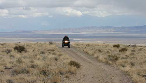
The Amasa ATV trail is located approx 51 miles west of Delta Utah. This trail offers riders 33 miles of desert and mountainous terrain ranging from easy to most difficult. Old mines and mining relics can viewed along its route. The trail borders the Notch Peak Wilderness Study Area with Notch Peak in plain view. Notch Peak is a 3,000 foot sheer cliff made of limestone and is hailed by many as the second tallest cliff face in America, second only to El Capitan in Yosemite National Park. The peak towers 9,725 feet above the desert valley which has an elevation of about 5,000 ft.
The lower portions of the trail offers that desert beauty, which by many is desolate and not very attractive. However Utah's west desert offers its own beauty if your willing to look around. Miller Canyon is just one of these locations that appears from a distance just as many of Utah's west desert mountain ranges, not much vegetation, dry and very rocky. However, a trip up this canyon you will be rewarded with beautiful views of limestone cliffs, bristle cone pines, aspen trees and large red rock boulders.
Another highlight of this trail is the Sink Hole. This 90 foot deep sink hole is thought to have been craved by an ancient river that washed away the earth below until in finally collapsed in upon itself.
 Today the Amasa ATV trail takes you right to the fence that surrounds this large hole to protect from wondering cattle and unsuspecting people as well.
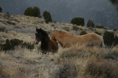
Spring time is great time to get out a ride this trail system. You can enjoy Utah's desert beauty as well as getting the opportunity to enjoy Utah's desert wildlife. When visiting this area be sure to carry plenty of water, gas, first aid kit, spare tire, tire repair kits, tools and other items as this area is very remote with Delta being the closest town for miles.
Driving Directions
From Delta travel approx 44.2 miles on Highway 6-50 to an dirt road marked with an old sign saying "Scenic Byway Loop Rd 6-50". Travel North on this road for approx 4.3 miles to the Miller Canyon sign.
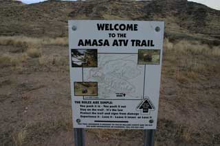
Travel west towards miller canyon and you will drive right by the staging area marked with the sign pictured above. The roads are well graded and even cars will have no problem. As always be prepared for the weather.
Other Articles of Interest:
Trilobite Collecting At U-DIG FOSSILS
Topaz Camp - Japanese Relocation Camp
Miller Canyon Utah's West Desert
Nearby Lodging (Affiliate Link):
We hope you enjoyed this information. For more outdoor activities, please connect with us on YouTube, Facebook and Instagram. Help us keep this site up and running by visiting our online store which features outdoor themed gifts, decor and more. Thank you for visiting and for your ongoing support!